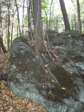
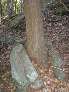
Exfoliation
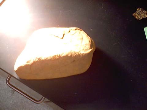
In the rock above, layers have peeled from the outside caused by exfoliation.
Photo by Phil Medina
 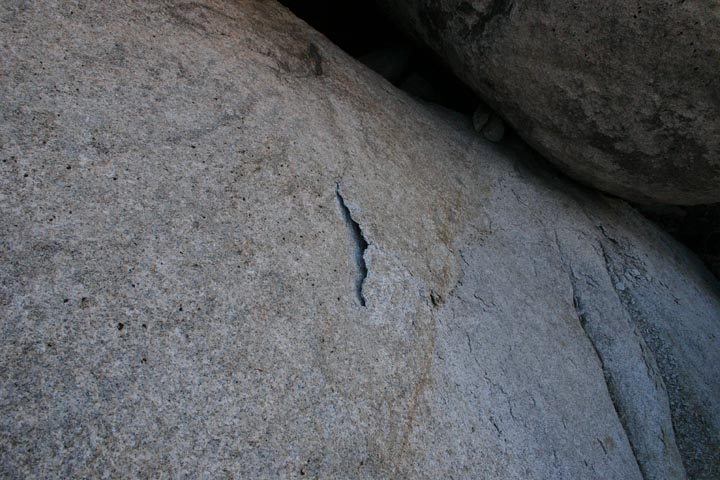
Exfoliation on Granite. Photo by Phil Medina, Mojave Desert
2009
-
Rocks formed deep in the Earth are made under high pressure.
-
When the pressure is released the rocks expand & crack.
-
May also be caused by alternate heating and cooling of rocks by weather conditions.
Abrasion- rubbing by other rocks.
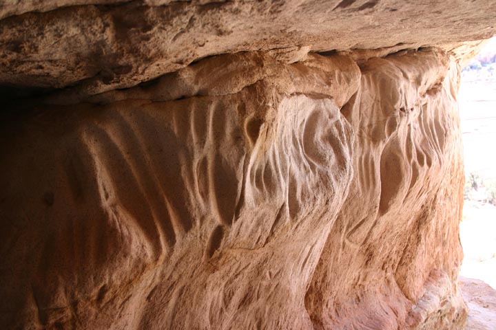
Abrasion in loose sandstone.
The gouges were made by hikers rubbing their fingers against the rock.
Photo by Phil Medina, Utah 2010
Chemical weathering is where the rock material is changed into another substance by reacting with a chemical.
Oxidation
- Oxygen in the atmosphere chemically reacts with minerals.
- ex.: rusting of a nail
Photoshop drawing by Phil Medina
Water (hydrolysis)
- Minerals are dissolved in water.
- ex.: Halite, calcite
Acid
- Carbonic acid:
- C02 dissolves in rain water forming a weak acid (seltzer).
- Acid Rain: Sulfur Dioxide in the atmosphere dissolves in rain water forming a strong acid (sulfuric acid).
Rates of weathering will be influenced by...
Surface area exposed - weathering occurs on the surface. More surface exposed, the faster the weathering will occur.
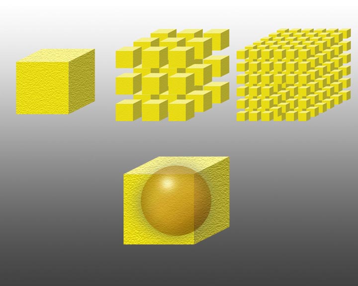
Surface Area photoshop drawing by Phil Medina
Mineral composition- some minerals are more resistant than others.
ex.:Quartz is resistant to chemical and physical weathering.
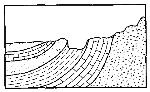
In the diagram above the different layers of the rock are weathered at different rates depending on the minerals within the rock. The layers sticking up most are the most resistant.
Climatic Conditions:
- Cold and/or dry climates favor physical weathering.
- Warm and wet climates favor chemical weathering.
- Frost action works best in areas where the temperature fluctuates wildly.
Soil - The product of weathering
Soil is made from rocks, minerals (mainly sand and clay), and organic material (regolith and organic matter)
Soil forms layers of different characteristics called horizons.
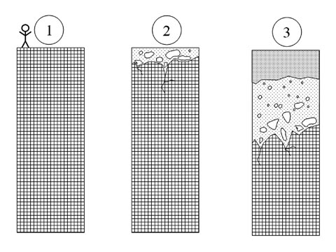
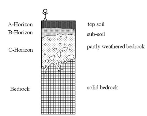
Residual soil is located above the rock that it is formed from (parent rock).
Transported soil has been moved from another location.
Most soil on the Earth's surface is transported.
| Horizon |
Layer |
Description |
| A |
Top Soil |
Small sediments and organic material |
| B |
Sub Soil |
Lighter in color, no organic material |
| C |
Partly-weathered Bedrock |
Larger rocks |
| Bedrock |
Bedrock |
Solid Rock |
Erosion- the process of moving sediment from one location to another.
The most important FORCE of erosion is GRAVITY. The most important AGENT of erosion is WATER.
The amount of erosion by a stream depends on the velocity and volume of water flow.
Velocity is influenced by the slope & volume of a stream.
As the velocity increases the size of the particles transported will get bigger. (See chart in Handy Dandy Earth Science Reference Tables)
Volume (amount of water flowing) is influenced by rainfall.
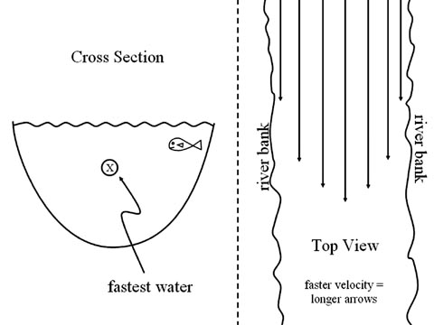
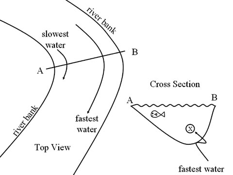
The shape of a stream will determine where erosion will occur.The fastest water goes to the outside of the curve. The outside curve gets eroded away.
In a straight run of water, the fastest water runs above center of the stream.
The rate of erosion increases where the velocity increases. (Direct Relationship)
Deposition- the process of dropping material out of transportation.
Kinetic and Potential Energy
- Kinetic Energy is the energy of motion.
- The faster an object moves, the higher its kinetic energy.
- Wherever the KE is high (fast water), there is a lot of erosion.
- Wherever the KE is low (slow water), there is a lot of deposition.
- Potential Energy is the potential to move.
- The high an object is, the higher its potential energy.
The characteristics of deposited particles give information about the erosion and deposition environments.
Water
- sediments get rounded and polished. Sorting occurs.
- particles can be fairly large.
- deposition occurs where the water slows down.
- ex.: where the river widens or where it dumps into a large body of water.
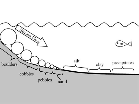
- As water slows gradually, smaller and smaller particles drop out causing horizontal sorting.
Horizontal Sorting
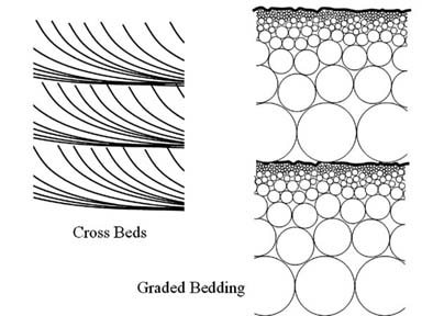
Crossbeds are formed when several horizontal sorting events happen on top of each other such as in a river delta as the stream meanders back and forth.
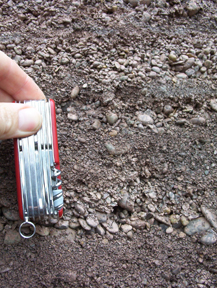
Graded bedding in a glacial esker.
-Photo by Phil Medina, NY July 2004
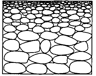
Graded Bedding comes from repeated vertical sorting events such as annual spring thaws.
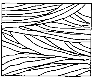
Crossbeds caused by the wandering mouth of a stream.
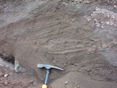
Crossbeds in a glacial esker.
-Photo by Phil Medina, NY July 2004
Vertical Sorting- caused by larger, rounder, denser sediments settling first.
Wind
- sediments are rounded and have a frosty appearance (tiny pits from impacts of flying sand) sorting occurs.
- particles are small
- Sand Dunes will be made
- Sand dunes have gently sloped windward sides and steeper leeward sides
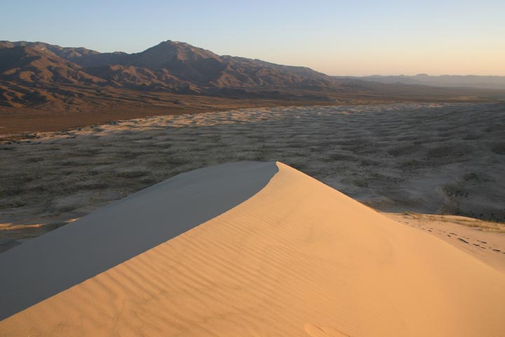
Sand dune at sunset.
Photo by Phil Medina, Kelso National Park, Mojave Desert 2008
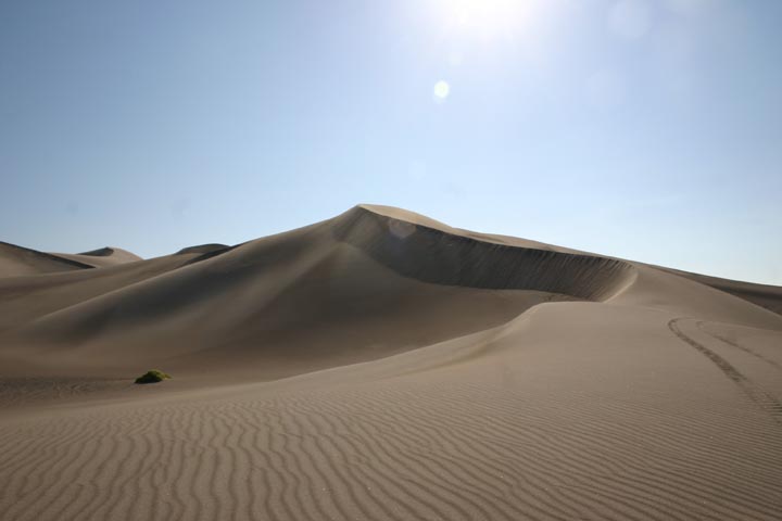
Sand dune field.
Photo by Phil Medina, Armagosa Valley, Nevada 2008
Ice (glaciers)
- Sediments are sharp-edged
- May have scratches or a polished side where they came in contact with the ground
- Deposits are unsorted and can be very large.
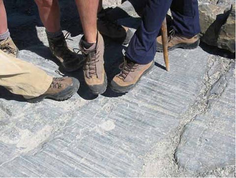
Parallel scratches in bedrock caused by the passage of a glacier.
Gravity by itself can transport sediments.
- Sharp-edged
- unsorted
- no limit in size
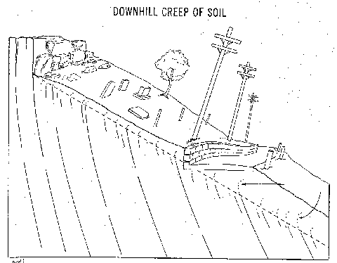
- often causes “mass wasting” such as landslides and downhill creep
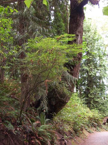
A living tree trunk
bent by downhill creep.
-Photo by Phil Medina, Seattle August 2004
Erosional/Depositional Systems
Glaciers- There are two types of glaciers: Alpine (or valley) and Continental (Ice Caps).
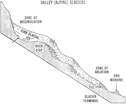
A side view of an alpine glacier.
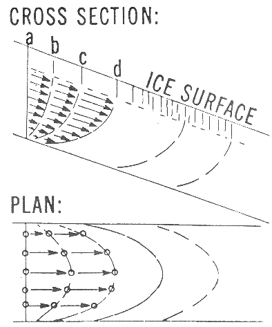
The slow motion flow of a glacier is similar to that of a river- fastest in the middle and slowest along the banks.
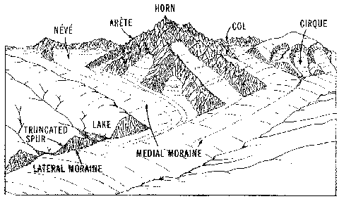
An alpine glaciated area
showing many of the typical features.
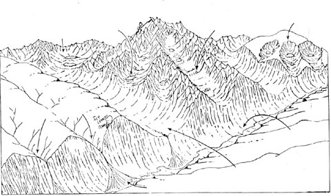
The same area after the glacial ice has melted away.
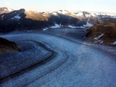
An alpine glacier in Alaska. Note the racing stripes of the medial moraines.
-Photo by Phil Medina, Aug 2004
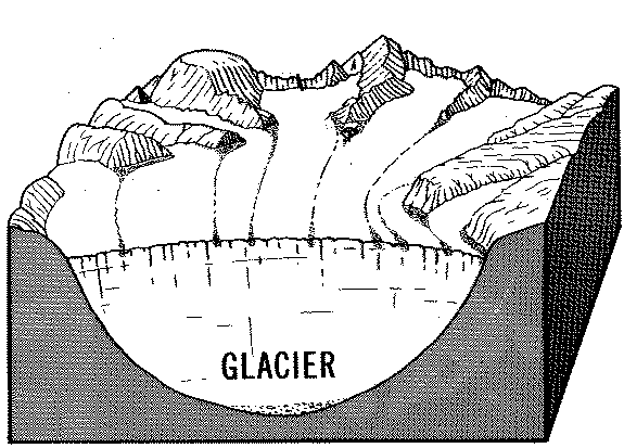
A diagramatic view showing how medial moraines form.
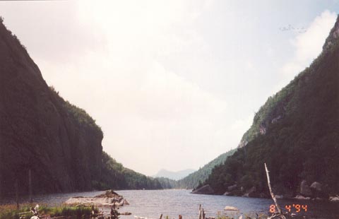
This picture taken on the way to Mt. Marcy (See Reference Tables) shows classic U-shaped valleys of a glaciated region.
-Photo by Phil Medina 1994
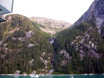
Another U-Shaped Valley in Alaska.
-Photo by Phil Medina, August 2004
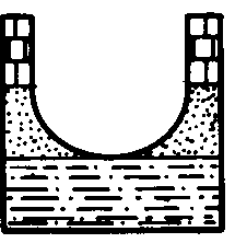 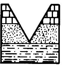
The U-shaped Valley on the left was made by a glacier while the V-shaped valley on the right was made by running water.
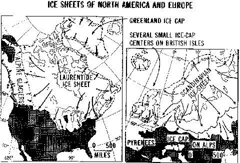
Continental Glaciers as they were at the peak of the Last Ice Age.

The the current continental glaciers on the planet. Note that the cross section at the bottom left shows that the weight of the glacier has pushed the center of Greenland below sea level!
Continental Glaciers
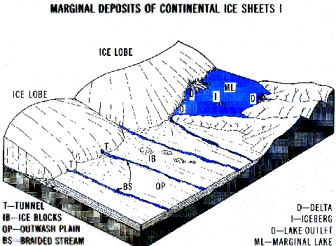
Diagram showing an active ice sheet and many of the features found at its edge.
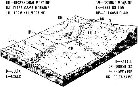
The same are after the glacire retreated.
Streams
In a straight section of a stream, the fastest water is in the middle above center.

On a curve, the fastest water gets thrown to the outside and that's where erosion will happen. The slowest water huggs the inside of the stream and that is where deposition takes place.

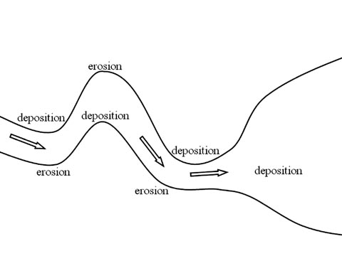
The meander widens from erosion on the outside and deposition on the inside.
The two sides of the meander erode into each other.
Water slows in the outside loop causing deposition . The loop gets cut off into an “Oxbow Lake” while the stream returns to a straighter course.
A Youthful Stream
- Narrow V-shaped
- Downcutting
- Swift water
- Steep gradient
- Erosion is dominant

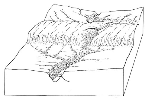
Valley continues to deepen.
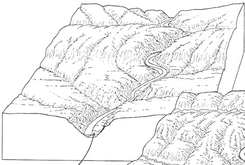
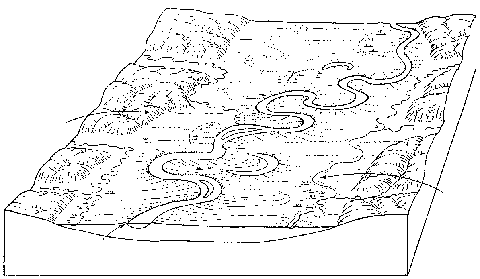
Mature Stream
- Lateral Erosion begins
- Meanders develop
- Floodplains develop
- Gradient lowers
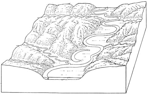
Old Age
- Wide meanders and oxbow lakes
- Wide floodplain
- Low velocity
- Low gradient
- Dynamic equilibrium between erosion and deposition
Waves
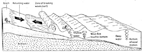
Wave action as seen under the waves
|
